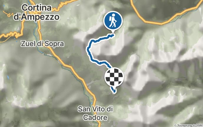
Pforzheimer Hütte - Roßkarscharte - Winnebachseehütte
Anzeige
Tourdaten
Details
Beste Jahreszeit: Februar bis April
Juni bis September
Juni bis September
- Einkehrmöglichkeit
Anzeige

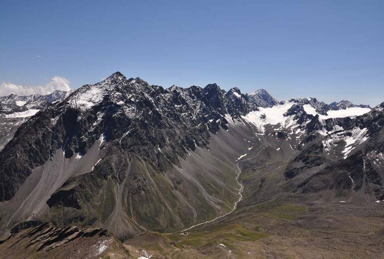
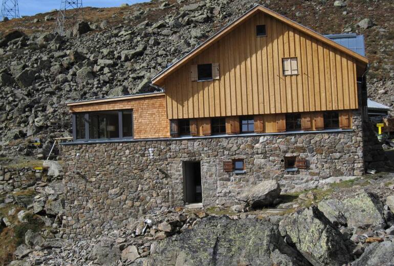
Blick ins obere Gleirschtal von der Haidenspitze 2975m. Die Hütte im Vordergrund.
Foto: Bruno Kohl

Pforzheimer Hütte
Foto: Bruno Kohl

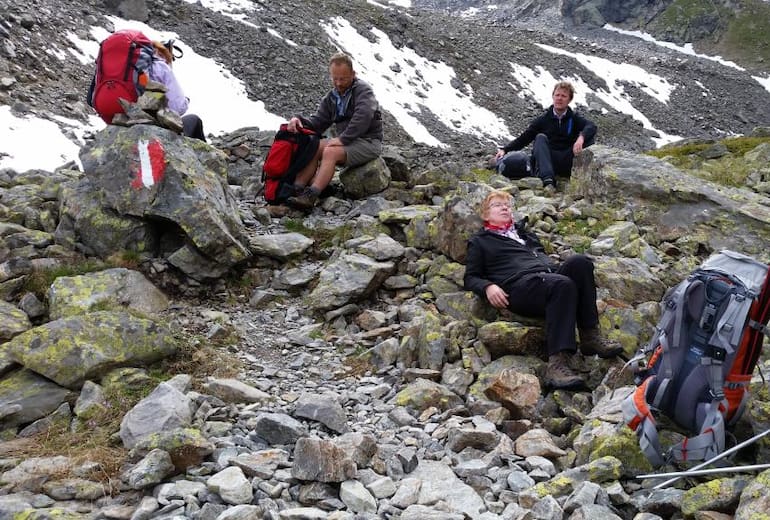
Seen auf dem Weg
Foto: Bruno Kohl
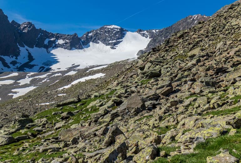
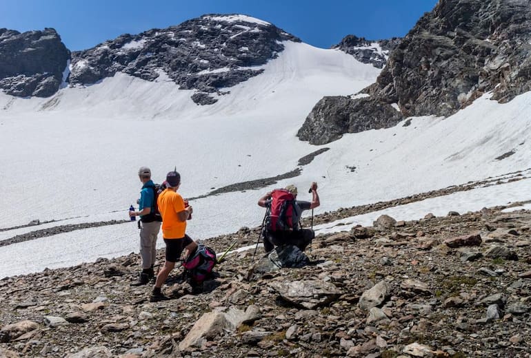
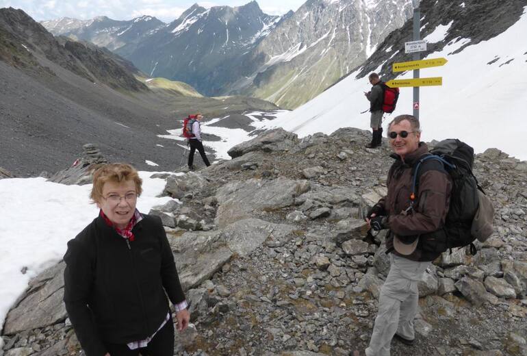
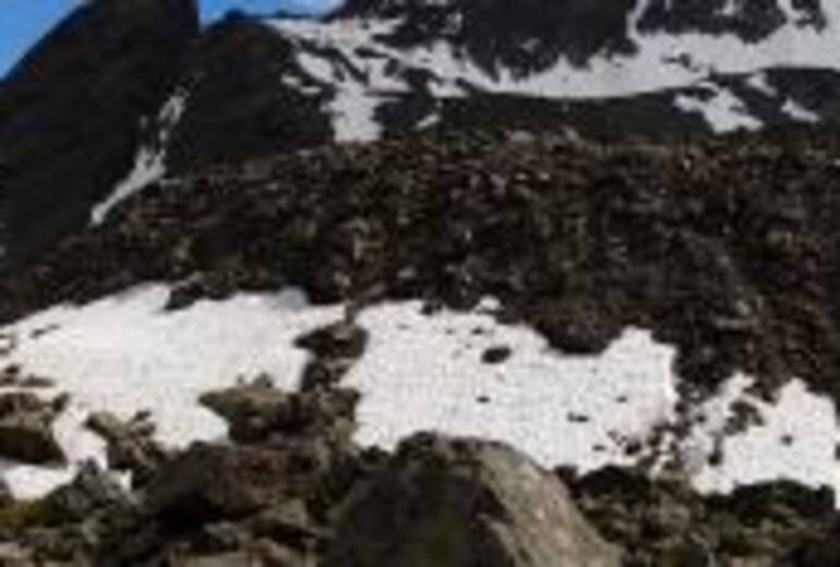
Die Roßkarscharte in der Mitte mit Firn bedeckt
Foto: Bruno Kohl
Alle 17 Fotos ansehen


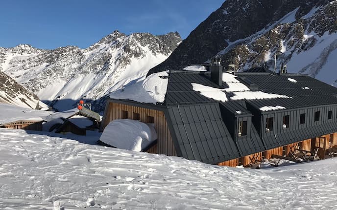
![]() Das Tiroler Westfalenhaus (2.273 m) liegt in den Stubaier Alpen, oberhalb des Sellrain- und des Lüsenstales. Die Hütte ist ein beliebter Stützpunkt für Besteigungen umliegender Dreitausender, wie etwa des Lüsener Fernerkogels oder der Lüsener Spitze. Sie ist auch Etappenziel von Mehrtageswanderungen durch diese Region der Österreichischen Zentralalpen.Die relativ leichten Zustiege aus dem Lüsenstal von Praxmar und Lüsens sind auch für Familien zu schaffen. Im Spätwinter und im zeitigen Frühjahr ist das Westfalenhaus Ziel vieler Skitourengeher und Schneeschuhwanderer. Deshalb ist das Haus auch ab Februar geöffnet.
Das Tiroler Westfalenhaus (2.273 m) liegt in den Stubaier Alpen, oberhalb des Sellrain- und des Lüsenstales. Die Hütte ist ein beliebter Stützpunkt für Besteigungen umliegender Dreitausender, wie etwa des Lüsener Fernerkogels oder der Lüsener Spitze. Sie ist auch Etappenziel von Mehrtageswanderungen durch diese Region der Österreichischen Zentralalpen.Die relativ leichten Zustiege aus dem Lüsenstal von Praxmar und Lüsens sind auch für Familien zu schaffen. Im Spätwinter und im zeitigen Frühjahr ist das Westfalenhaus Ziel vieler Skitourengeher und Schneeschuhwanderer. Deshalb ist das Haus auch ab Februar geöffnet.- Geöffnet
- Feb - Okt
- Verpflegung
- Bewirtschaftet
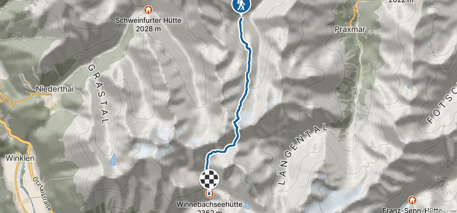
![]() Nördlich über Gries im Sulztal in den Stubaier Alpen in Tirol gelegen, genießt man auf dieser Hütte, an die sich ein kristallklarer Bergsee schmiegt, den Ausblick auf die grandiose Bergwelt und auf einen imposanten Wasserfall. Die Hütte ist Ziel- und Stützpunkt von Wanderern, Bergsteigern, Kletterern, Skitourengehern und Schneeschuhwanderern, die die umliegenden Gipfel, darunter neun Dreitausender, oder den Adlerweg, in Angriff nehmen.Spektakulär ist auch der Gletscher-Panorama-Marsch von Gries über die Winnebachseehütte, das Zwieselbachjoch, die Guben-Schweinfurter Hütte und weiter nach Niederthai. Mitunter „verirren“ sich auch Mountainbiker auf die Hütte, die sich nicht nur bis hierher mühen, sondern auch noch weiter bis zum Seblaskogel, um danach eine waghalsige Abfahrt zu genießen.Der hütteneigene Klettergarten Kleinkanada wurde von erfahrenen Bergführern eingerichtet und bietet Routen bis zum 6. Schwierigkeitsgrad. Der markante Felsriegel ist keine zehn Gehminuten entfernt und eignet sich auch für Anfänger und Familien. Für Kleinkinder ist der Klettergarten, da der Ausgangsstandplatz etwas abschüssig ist, weniger geeignet.
Nördlich über Gries im Sulztal in den Stubaier Alpen in Tirol gelegen, genießt man auf dieser Hütte, an die sich ein kristallklarer Bergsee schmiegt, den Ausblick auf die grandiose Bergwelt und auf einen imposanten Wasserfall. Die Hütte ist Ziel- und Stützpunkt von Wanderern, Bergsteigern, Kletterern, Skitourengehern und Schneeschuhwanderern, die die umliegenden Gipfel, darunter neun Dreitausender, oder den Adlerweg, in Angriff nehmen.Spektakulär ist auch der Gletscher-Panorama-Marsch von Gries über die Winnebachseehütte, das Zwieselbachjoch, die Guben-Schweinfurter Hütte und weiter nach Niederthai. Mitunter „verirren“ sich auch Mountainbiker auf die Hütte, die sich nicht nur bis hierher mühen, sondern auch noch weiter bis zum Seblaskogel, um danach eine waghalsige Abfahrt zu genießen.Der hütteneigene Klettergarten Kleinkanada wurde von erfahrenen Bergführern eingerichtet und bietet Routen bis zum 6. Schwierigkeitsgrad. Der markante Felsriegel ist keine zehn Gehminuten entfernt und eignet sich auch für Anfänger und Familien. Für Kleinkinder ist der Klettergarten, da der Ausgangsstandplatz etwas abschüssig ist, weniger geeignet.- Geöffnet
- Jun - Okt
- Verpflegung
- Bewirtschaftet